Ⅰ. General Information of the Public Notice
According to the relevant provisions of Maritime Traffic Safety Law of the People's Republic of China, Zhejiang Maritime Safety Administration issued the Public Notice on the Adjustment of Main Public Shipping Routes along Coast of Zhejiang Province on August 30, 2021, which will be formally implemented from September 10, 2021.
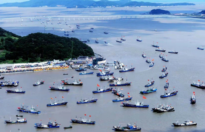
The adjustment of sea route will be helpful to establish a relatively clear borderline between ship's routes and fishing areas, and reduce the potential risk of collision incidents between commercial vessels and fishing vessels.
Ⅱ. Brief on the Public Notice and the Adjusted Routes
After optimization and adjustment, the 15 main shipping routes along the coast of Zhejiang are shown in the pattern of “three vertical and six horizontal routes”.
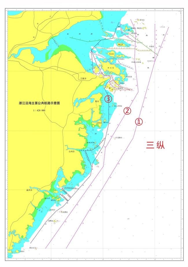

From east to west, the “three vertical routes” consists of “Outer Route, East Route and West Route”.
① Outer Route: It is the main shipping route of the North-South Channel along the coast of China, mainly serving large ships sailing in the north-south direction.
② East Route: Located between the Outer Route and the West Route, it runs through the coast of Zhejiang Province from north to south, mainly serving ships entering and leaving the Yangtze River and ships of about 10,000 tons sailing on the north-south route.
③ West Route: It is located at the innermost side of the “three vertical”, close to the coast and islands, and mainly serves small and medium-sized ships of 5,000 tons and below.
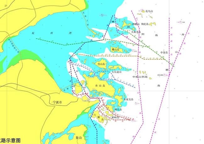
“Six horizontal routes” are the main channels for ships entering and leaving Zhejiang ports from the direction of east to west. They are composed of the entry and exit routes in six areas with numerous ports, namely, “Northern Zhoushan, Central and Northern Zhoushan, Central Zhoushan, Core port area of Ningbo-Zhoushan Port, Taizhou Bay, Wenzhou Port and Yueqing Bay” from north to south.
Among them, the route map of “Zhoushan, Central and Northern Zhoushan, Central Zhoushan, Core port area of Ningbo-Zhoushan Port” is illustrated as follows:
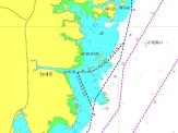
The route map of “Taizhou Bay” is illustrated as follows:
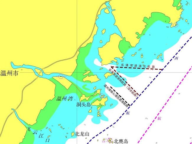
The route map of “Wenzhou Port and Yueqing Bay” is illustrated as follows:

The route map of “Taizhou Bay” is illustrated as follows:

The route map of “Wenzhou Port and Yueqing Bay” is illustrated as follows:

Ⅲ. Attention and Caution
1. The route width is the theoretical width, and the waterway restricted by natural environment and navigation conditions, shall be limited to its actual width of the navigable water area.
2. The ship shall select the route scientifically and reasonably according to the characteristics of the ship and the port of destination with reference to the latest navigation materials. For large ships passing through the coastal areas of Zhejiang, it is recommended to choose the outer route preferentially and pass through the east side of the Haijiao.
3. The ship shall maintain a proper lookout, keep the equipment of AIS in good working condition and a listening watch on VHF, and switch to the watchkeeping channel in time after entering the VTS area.
4. The ship shall proceed on the right side of the central line of the route at a safe speed and avoid parallel running with other ships for a long time with due regard to the observance of good seamanship. Particular caution shall be taken when entering and leaving the fairway, passing through the high traffic density and the traffic crossing area. When crossing the fairway, the ship shall cross on a heading as nearly as practicable at right angles to the general direction of traffic flow.
5. The vessel shall avoid anchoring and operating in the fairway waters.


