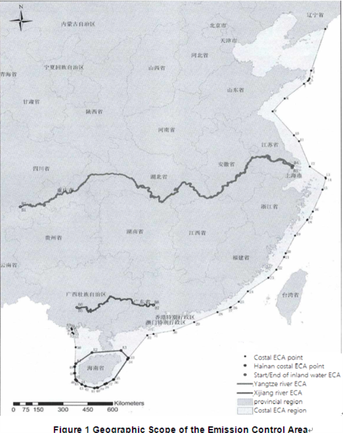
| Type | Emission control area② | Non emission control area | |||
| Coastal control area③ | Inland river control area④ | Coastal waters | Inland waters | ||
| Sea area in Hainan waters | Other waters | ||||
| International ship⑤ |
From 1 Jan, 2020, use fuel oil with sulphur content not exceeding 0.50% m/m (Hereinafter referred to as “Compliant Fuel Oil”) |
||||
| From 1 March 2020, not carry self-use fuel oil with sulphur content exceeding 0.50% m/m (Hereinafter referred to as “Non-compliant Fuel Oil”) | |||||
| From 1 Jan 2022, not exceeding 0.10% m/m | -- | From 1 Jan, 2020, not exceeding 0.10% m/m | -- | -- | |
| Ship | Shall not discharge effluent from the exhaust gas cleaning system (EGCS) with open loop systems | -- | |||

|
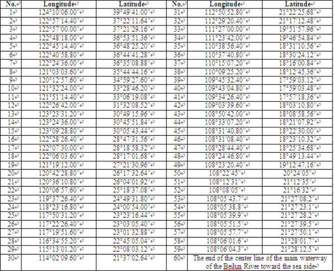
Inland river control area |
Boundary name |
Name of the location |
Description of the location |
Location No. |
Longitude | Latitude |
|
Main stream of the Yangtze River |
Starting point |
Shuifu Yunnan |
Xiangjiaba Bridge | B1 | 104°24′30.60″ | 28°38′22.38″ |
| B2 | 104°24′35.94″ | 28°38′27.84″ | ||||
|
Ending point |
Mouth of the Liuhe river Jiangsu |
Line connecting Liuheiwu in the lower reaches of the mouth of the Liuhe River and Shixin signal pole in the lower reaches of the Shiqiao River Chongming island |
B3 | 121°18′54.00″ | 31°30′52.00″ | |
| B4 | 121°22′30.00″ | 31°37′34.00″ | ||||
|
Main stream of the Xijiang River |
Starting point |
Nanning Guangxi |
Minsheng Terminal of Nanning |
B5 | 108°18′19.77″ | 22°48′48.60″ |
| B6 | 108°18′26.72″ | 22°48′39.76″ | ||||
|
Ending point |
Zhaoqing Guangdong |
Line connecting Tiexianjiao, Jinli and Shangzui, Yongkou, Wudinggang on the trunk stream of the Xijiang River |
B7 | 112°48′30.00″ | 23°08′45.00″ | |
| B8 | 112°47′19.00″ | 23°08′01.00″ |
Please Contact Us at:
 Reporting Requirements for Foreign-flagged Ships En
  Shipping Carriers Move to Prevent Deadly Charcoal F
  KR, HD KSOE, HD HHI, KSS Line, and Liberian Registr
 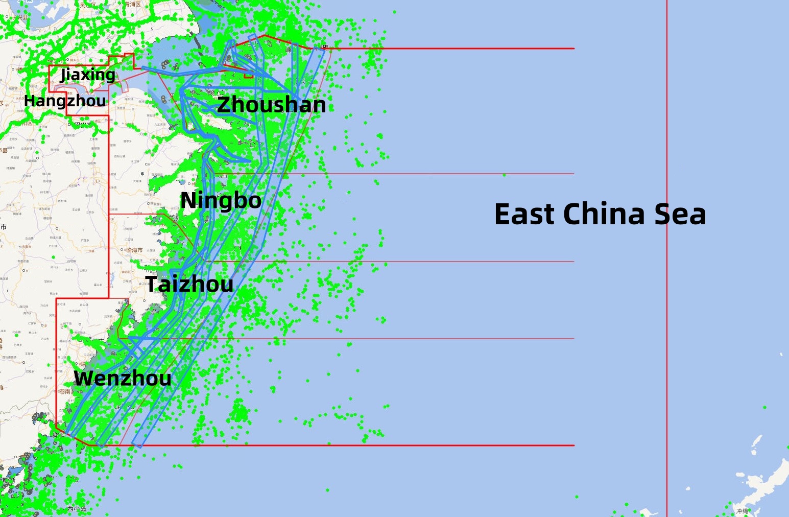 Zhejiang Maritime Safety Administration Issues the “
  RightShip Updates Age Trigger for Vessel Inspection
 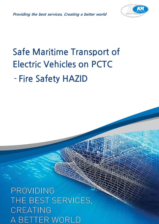 KR Publishes Report on Safe Maritime Transport of E