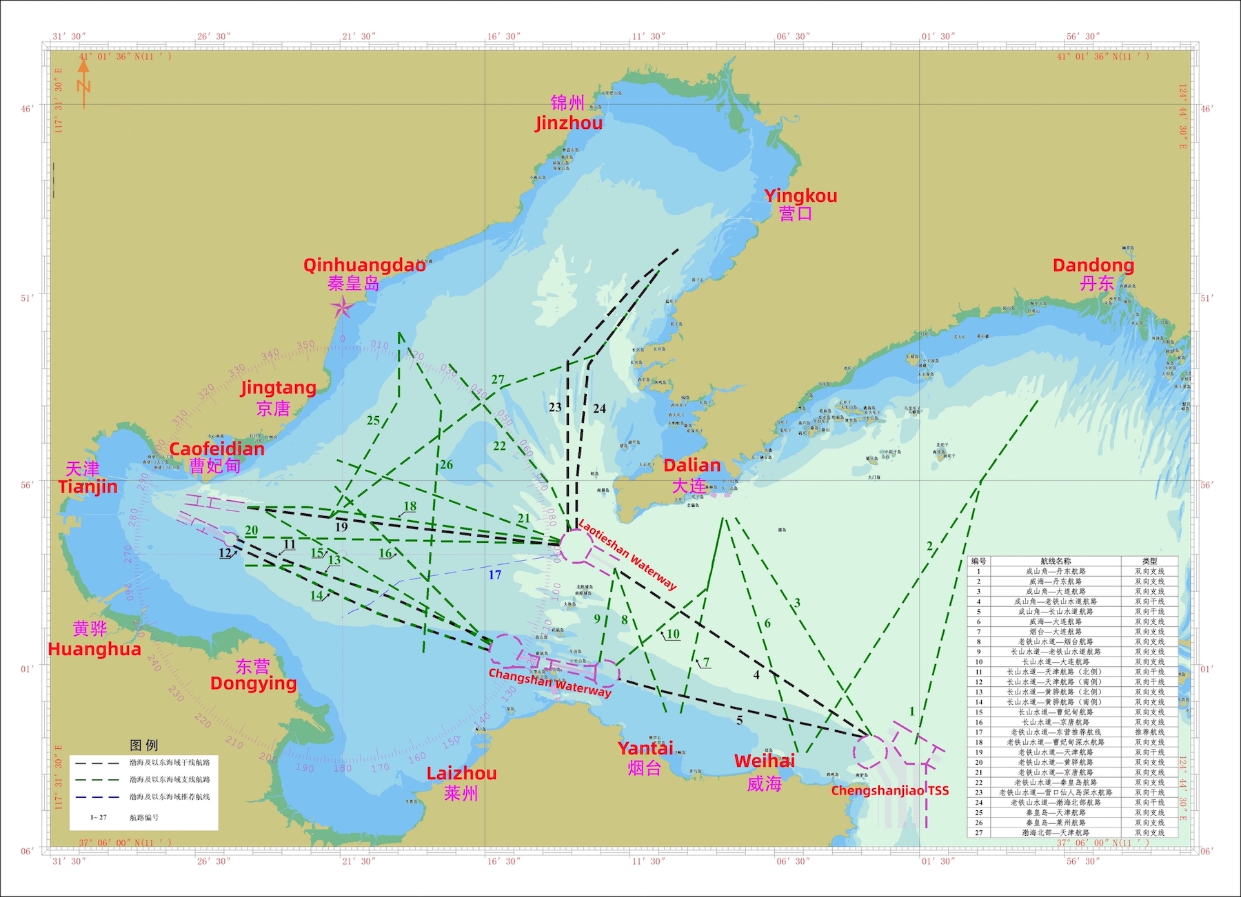
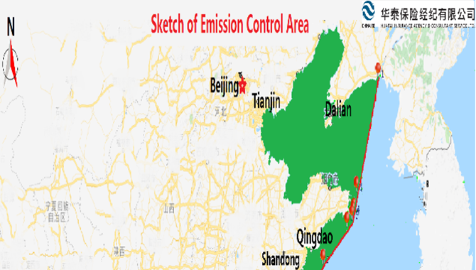
Recently, the Tianjin, Liaoning, Hebei and Shandong MSA jointly published a total of 27 main public routes in the Bohai Sea and its eastern waters, which has been implemented since December 18, 2023. These public routes sort out the traffic flow of merchant ships in the Bohai Sea and its eastern waters, and provide the route planning basis for ships when entering or leaving the Bohai Sea and navigating between ports in the Bohai Sea and its eastern waters, which shall contribute to the improvement on the navigation safety of ships in this sea area.
Main Public Routes in the Bohai Sea and its Eastern Waters
Totally 27 public routes are published and implemented and all of them are two-way routes, these public routes are divided into three types: two-way main routes, two-way feeder routes and recommended routes. Please refer to Attachment for specific details.
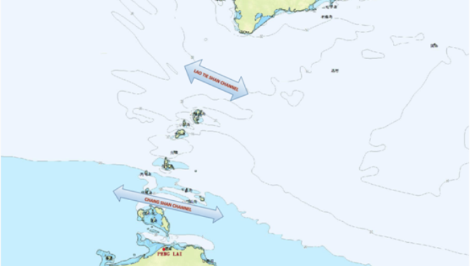
Sketch map of the main public routes (center line)in the Bohai Sea and its eastern waters
Brief Explanation of the Main Public Routes by MSA
The MSA has provided a brief explanation of the public routes and the key points are extracted and summarized as follows:
1. All the public routes published and implemented are two-way routes, the routes are divided into three types: two-way main routes, two-way feeder routes and recommended routes. Among them, the No.4 route "Chengshanjiao - Laotieshan Waterway" and the No.5 route "Chengshanjiao - Changshan Waterway" are the main routes for ships entering or leaving the Bohai Sea.
2. The turning point on the center line described in the route list is for the purpose of indicating the route position and direction only, and is not the route and course that recommended for ships to use. In addition, the route width in the list is the theoretical width, the width of a route restricted by natural environment or navigation conditions shall be limited to the width of the navigable waters.
3. The ships shall strictly comply with the COLREGS and the special provisions published by the MSA (if any). When a ship is navigating in the route, attention should be paid to the change of the sounding depth to prevent the ship from grounding accidents. The ship shall navigate with extreme caution when entering, leaving or crossing the route, passing through the dense traffic waters or the intersection waters of the route. In addition, when a ship crosses the route, it is recommended that, as far as practicable, cross at right angles to the route or to the traffic flow without impeding the safe navigation of other ships.
4. Ships shall as far as possible, navigate to the right of center line of the route. The ship shall reasonably formulate her route according to her characteristics and the real environment of the sea area through which she is navigating, and with reference to the latest nautical charts and publications.
5. In any case, the public route is only used as the recommended passage for ships navigating in the Bohai Sea and its eastern waters, it is only for the reference of the master or crew, and does not exempt the master or crew from their responsibility for the safe navigation of the ship.
attachment:
source:
Huatai Insurance Agency & Consultant Service Ltd.
The opinions expressed herein are the author's and not necessarily those of The Xinde Marine News.
Please Contact Us at:
media@xindemarine.com


.gif)