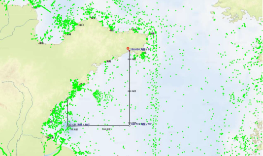
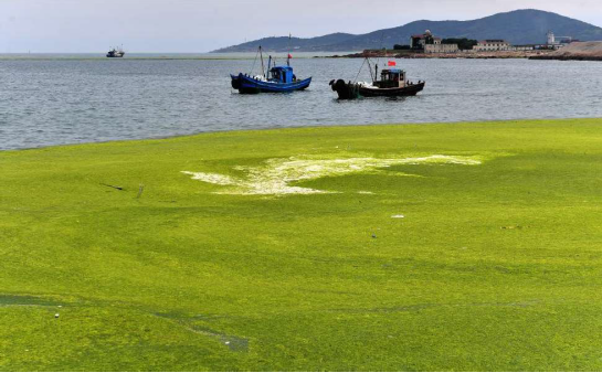
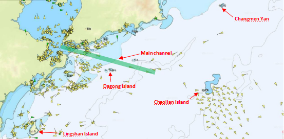
The general scope of the clean-up operation is: longitude: from 120°Eto 122°E; latitude: from 35°N to the southern coastal waters of Shandong Peninsula. The clean-up operation waters mainly cover most navigable coastal waters of Qingdao including the main channel, Lingshan Island, Chaolian Island and Changmenyan. For your easy reference, below is an illustration of the scope of the clean-up operation and key navigable waters.

1. Unless it is necessary, try to avoid the above key navigable waters. When choosing navigation routes, ships shall stay away from the coast, apply the recommended routes properly and strictly follow the Ship Routing System.
2. Please note that fishing boats may be restricted in their ability to maneuver during cleaning-up operation. Ships shall maintain proper lookouts, keep AIS in good working condition, keep watching on radars and listening to VHF, after entering the area of the clean-up operation.
3. Try to coordinate the collision avoidance actions through VHF CH16. However, if there is no response from the fishing boat after several calls, it might mean that the fishing vessel does not maintain watching on such channel. When communicating on VHF, please give full consideration to the possible language barrier, different accent and language expression and ensure that both parties are clear about each other’s intention. If necessary, seek assistance from VTS in communicating with the fishing boat involved.
4. Comply with the COLREG 1972 at all times.
Source: Oasis
The opinions expressed herein are the author's and not necessarily those of The Xinde Marine News.
Please Contact Us at:
media@xindemarine.com


 Ningbo Containerized Freight Index Weekly Commentar
  Ningbo Containerized Freight Index Weekly Commentar
  Ningbo Containerized Freight Index Weekly Commentar
  BIMCO Shipping Number of the Week: Bulker newbuildi
  Ningbo Containerized Freight Index Weekly Commentar
  Ningbo Containerized Freight Index Weekly Commentar