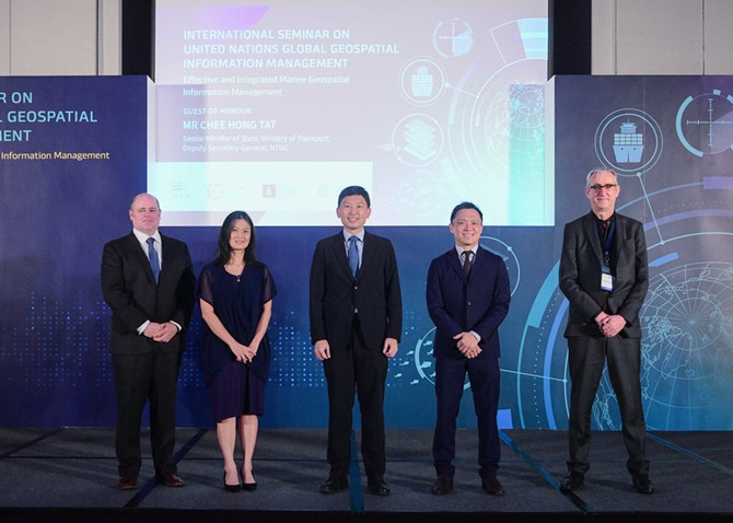
The Maritime and Port Authority of Singapore (MPA) is hosting the first International Seminar on United Nations Global Geospatial Information Management from 10 to 12 May 2022. Themed ‘Effective and Integrated Marine Geospatial Information Management’, this hybrid seminar is jointly organised by MPA, the United Nations Global Geospatial Information Management Section, Statistics Division, Department of Economic and Social Affairs, the United Nations Working Group on Marine Geospatial Information, the Marine Spatial Data Infrastructure Working Group of the International Hydrographic Organization (IHO), and the Marine Domain Working Group of the Open Geospatial Consortium (OGC).
Leading international experts from academic and research institutions in the field of marine geospatial information are gathered at the seminar to share and exchange their expertise on strategies to address key global issues such as climate change, disaster risk management, emergency response, as well as environmental management and protection. The plenary sessions will cover topics including effective governance, policy and legal frameworks, financing, data, innovation, and standards for integrated marine geospatial information management. Please refer to the Annex for the full programme of the International Seminar.
The International Seminar is also held alongside the Third Expert Meeting of the United Nations Working Group on Marine Geospatial Information, the 13th meeting of the Working Group on Marine Spatial Data Infrastructure of the International Hydrographic Organization, and the 2022 meeting of the Marine Domain Working Group of the Open Geospatial Consortium, from 9 to 13 May 2022. These meetings provide a forum for dialogue and coordination among Member States, the United Nations system, and international organisations like the IHO and OGC, to enhance regional and global cooperation, advocate and improve the availability and accessibility of marine geospatial information.
Senior Minister of State for Transport, Mr Chee Hong Tat, was the Guest of Honour at the opening ceremony of the International Seminar today. “Having high-quality land-sea navigational and seabed data allows us to plan and make policy decisions more effectively, so that we can achieve better outcomes such as more efficient transport routes, reduced fuel consumption and safer navigation. It also enables stronger partnerships and opens up new possibilities,” said Mr Chee.
GeoSpace-Sea web portal to be made accessible to the public
From August this year, the GeoSpace-Sea web portal will be made accessible to the public. Launched in 2019, GeoSpace-Sea, an initiative by 12 [1] government agencies, is Singapore's national marine spatial data infrastructure that harnesses and integrates marine and coastal geospatial data from diverse sources. GeoSpace-Sea provides comprehensive and consolidated geospatial information which is used for various applications including port, marine and coastal planning, and environmental management. The web portal allows users to securely upload and download data, and will facilitate collaboration among government, industry and academia in areas such as marine science research and development (R&D), marine conservation and climate change adaptation. A wider suite of functions such as data visualisation, analytical tools and reports will subsequently be made available.
GeoSpace-Sea has also supported national sustainability initiatives such as monitoring and understanding the impact of climate change. The National Sea Level Programme, coordinated by the Centre for Climate Research Singapore under the National Environment Agency, aims to deepen understanding of how rising sea levels could affect Singapore; and the Coastal-Inland Flood Model, currently being developed by PUB, aims to enable holistic flood risk assessment and aid in the planning of coastal protection measures by simulating the combined effects of extreme sea levels and inland flooding caused by intense rainfall.
GeoSpace-Sea will also be used in digitalPORT@SGTM, a one-stop platform for port clearance and just-in-time services, to provide up-to-date information on vessel activity, optimise the use of anchorage space, and achieve faster turn-around time at ports, lowering the carbon footprint generated by vessels due to shorter port stays.
GeoSpace-Sea is partnering the Technology Centre for Offshore and Marine, Singapore (TCOMS), a national R&D centre dedicated to maritime and other ocean sectors, to provide data on tides, currents, waves and storm surges for better prediction of the hydrodynamic environment around Singapore. This will enable relevant agencies to respond to marine incidents or disasters, such as oil spills and storm surges, more proactively.
Partnerships to drive innovation and collaboration
In October 2021, Singapore and IHO launched the Joint IHO-Singapore Innovation and Technology Laboratory to optimise resources of IHO Member States to harness and develop emerging technologies in the hydrographic domain that support safe maritime navigation and protection of the marine environment.
The IHO Lab is currently working on projects to facilitate the adoption and use of the IHO S-100 [2] - based Product Specifications (e.g. bathymetry, currents, tides), which allow for greater interoperability of navigational datasets and technologies to enhance decision making. In addition, the IHO Laboratory will be joining the IHO Maritime Autonomous Surface Ships (MASS) Navigation Project Team to contribute to the work needed for the establishment of MASS navigation data standards, including facilitating MASS test bedding in Singapore port waters.
In efforts to drive innovation, the IHO-Singapore Lab also initiated discussions with TCOMS to tap on their expertise and capabilities. The three-way partnership between IHO, TCOMS and Singapore allows for three progressive types of use-case testing and fine-tuning namely - digital modelling, controlled environment testing using TCOMS Deepwater Ocean Basin research facility, and field test-bedding in Singapore's waters. This collaborative development will pave the way for safer and more efficient operations of future maritime and ocean systems, harnessing synergies across the government research and industry sectors.
The opinions expressed herein are the author's and not necessarily those of The Xinde Marine News.
Please Contact Us at:
media@xindemarine.com


.gif)
 Ningbo Containerized Freight Index Weekly Commentar
  Ningbo Containerized Freight Index Weekly Commentar
  BIMCO Shipping Number of the Week: Bulker newbuildi
  Ningbo Containerized Freight Index Weekly Commentar
  Ningbo Containerized Freight Index Weekly Commentar